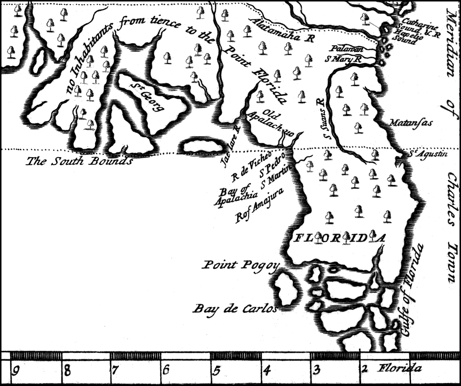
Description: A portion of Bernard's map showing Florida as it was known in 1737. Digitization provided by the USF Libraries Digitization Center. Rare Maps Collection: Notes from USF Library: Relief shown pictorially. This map shows the longitude based on the Meridian of Charles Town (Charlestown) South Carolina, and the northern and southern bounds of Carolina encompassing Georgia and a large portion of Florida. Population estimates of various Native American nations is given, including a note that peninsular Florida is uninhabited. Rare example of earliest views of South Florida Scale [ca. 1:9,000,000]
Place Names: 1720-1739, Saint Augustine
ISO Topic Categories: inlandWaters, oceans, society, transportation
Keywords: Detail of Bernard's Map Showing Florida, physical, statistical, historical, physical features, topographical, population, ethnological, inlandWaters, oceans, society, transportation, Unknown,1737
Source: Jean Frederic Bernard, Bernard (J.F.) Recueil de voiages. 160. Amsterdam, 1737. v. 9. Decouverte d'un pays plus grand que l'Europe, situe dans l'Amerique .../ par le P. Hennepin, (p. 1-464 la fin du vol.) (Amsterdam, : J.F. Bernard , 1737)
Map Credit: Courtesy of the Special Collections Department, University of South Florida. |
|