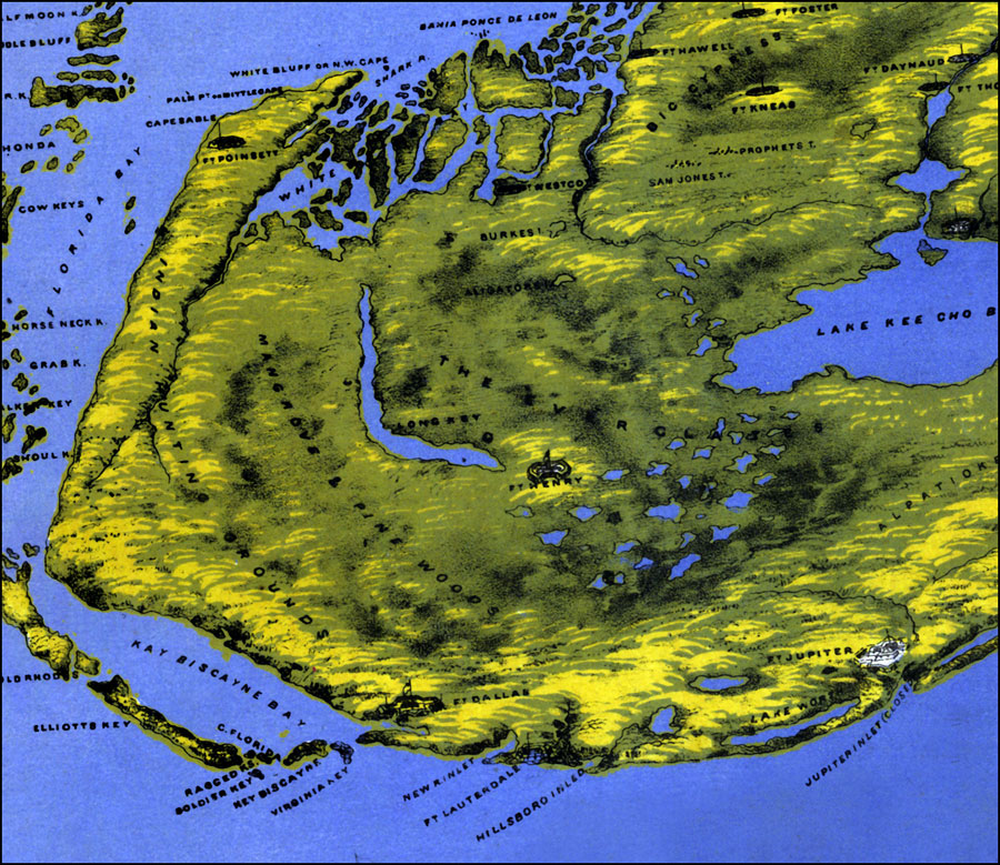
Description: A portion of Bachmann’s panoramic map of Florida showing the southern section of peninsular Florida. North is oriented to the right of the map. Digitization provided by the USF Libraries Digitization Center. Rare Maps. This is a perspective map drawn from nature and lithography showing a bird's eye view of Florida during the Civil War, circa 1861. This map shows forts, cities and towns as well as Indian Hunting Grounds and the Everglades terrain.
Place Names: 1860-1879, Key West, Fort Lauderdale, Atlantic Ocean, Gulf of Mexico
ISO Topic Categories: inlandWaters, society
Keywords: Panorama of the seat of war of Southern Florida , historical, physical, physical features, Civil War, inlandWaters, society, Unknown,1861
Source: John Bachmann, lithographer, (New York, NY: John Bachmann, 1861)
Map Credit: Courtesy of the Special Collections Department, University of South Florida. |
|