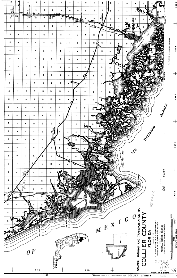
Description: This is a detailed map of the south portion of the county of Collier in the state of Florida. Section Township Range (STR) is shown. This map shows all of the main cities, US highways, state roads, bridge highways, drawbridge highways, federal aided highway, saw mills, railroads, inland waters, corporate lines, county boundaries, farm units, dwellings other than farms, businesses, camps, hotels, county seat, scenic site and schools. Key to Florida Highway maps.
Place Names: Collier, Ten Thousand Islands, Deep Lake, Matmon, Copeland, Carnestown, Fakahatchee Bay, Chokoloskee, Chokoloskee Bay, Everglades, Everglades City, Royal Palm Hammock, Belle Meade, Collier City, Gulf of Mexico, Gullivan Bay, Cape Romano, Rookery Bay
ISO Topic Categories: boundaries, location, transportation, inlandWaters, oceans
Keywords: South Collier, physical, political, transportation, physical features, major political subdivisions, county borders, local jurisdictions, roads, railroads, boundaries, location, transportation, inlandWaters, oceans, Unknown,1936
Source: , Florida State Road Department (, FL: , 1936)
Map Credit: Courtesy the private collection of Roy Winkelman. |
|