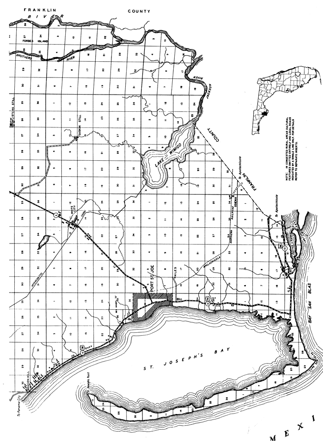
Description: This is a detailed map of the south portion of the county of Gulf in the state of Florida. Section Township Range (STR) is shown. This map shows all of the main cities, state roads, US Highways, bridge highways, drawbridge highways, federal aided highway, inland waters, canals, ferries, corporate lines, county boundaries, camps or lodges, turpentine stills, farm units, dwellings other than farms, hotels, businesses and seasonal dwellings. Key to Florida Highway maps.
Place Names: Gulf, St. Joseph's Point, St. Joseph's Bay, Port St. Joe, Niles, White City, Gaskin Still, Listers Still, Intercoastal Canal, Lake Wimico, Brothers River, Forbes Island, Apalachicola River, Jackson River, Odena, Indian Lagoon, Indian Pass, Bay San Blas, Beacon Hill, White City
ISO Topic Categories: boundaries, inlandWaters, location, transportation
Keywords: South Gulf, physical, political, transportation, physical features, major political subdivisions, county borders, local jurisdictions, roads, railroads, boundaries, inlandWaters, location, transportation, Unknown,1936
Source: , Florida State Road Department (, FL: , 1936)
Map Credit: Courtesy the private collection of Roy Winkelman. |
|