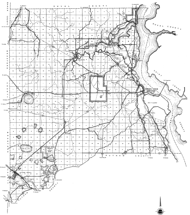
Description: This is a detailed map of the county of Clay in the state of Florida. Section Township Range (STR) is shown. This map shows all of the main cities, state roads, US Highways, bridge highways, drawbridge highways, federal aided highway, saw mills, railroads, inland waters, canals, ferries, corporate lines, county boundaries, county seat, airports, camps or lodges, post offices, turpentine stills, forest ranger lookout station, cemeteries, seasonal dwellings, churches, farm units, dwellings other than farms, tenant houses, businesses, townhalls, hotels, schools, hospitals and factories. Key to Florida Highway maps.
Place Names: Clay, Highland, Rideout, Middleburg, Doctors Inlet, Orange Park, Doctors Lake, Arrendo, Russell, Penney Farms, Green Cove Springs, Black Creek, Saint Johns River, Walkill, Hibernia, Kingsley Lake, Kingsley, Belmore, Gold Head Branch State Park, Sand Hill Lake, Lake Johnson, West Tocoi, Leno, Keystone Heights, Lake Geneva, Peoria
ISO Topic Categories: boundaries, location, transportation, inlandWaters
Keywords: Clay, physical, political, transportation, physical features, major political subdivisions, county borders, local jurisdictions, roads, railroads, boundaries, location, transportation, inlandWaters, Unknown,1936
Source: , Florida State Road Department (, FL: , 1936)
Map Credit: Courtesy the private collection of Roy Winkelman. |
|