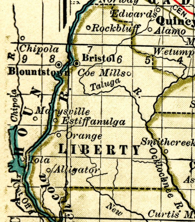
Description: A map of Liberty County showing forts, major cities, towns, bodies of water, county lines, the county seat (Bristol) current to 1897. Township and Range grids extending from the Tallahassee Meridian and Tallahassee Base Line are shown.
Place Names: Liberty, Rock Bluff, Bristol, Coes Mills, Estiffanulga, Orange, Alligator
ISO Topic Categories: boundaries, inlandWaters
Keywords: Liberty County, physical, political, physical features, county borders, boundaries, inlandWaters, Unknown,1897
Source: , The Century Atlas (New York, NY: The Century Co., 1897) 39
Map Credit: Courtesy the private collection of Roy Winkelman. |
|