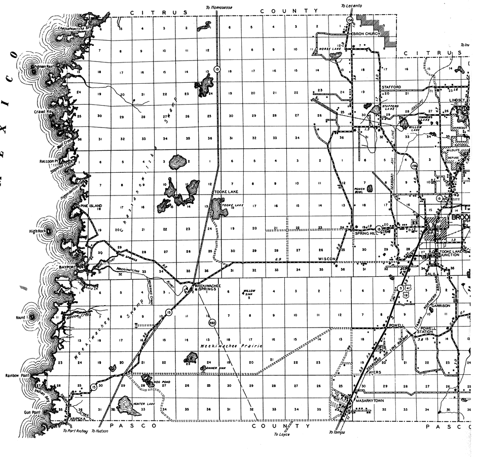
Description: This is a detailed map of the west portion of the county of Hernando in the state of Florida. Section Township Range (STR) is shown. This map shows all of the main cities, state roads, US Highways, bridge highways, federal aided highway, railroads, inland waters, corporate lines, county boundaries, county seat, schools, churches, camps, sawmills, turpentine stills, cemeteries, factories, seasonal dwellings, hotels, farm units and dwellings other than farms. Key to Florida Highway maps.
Place Names: Hernando, Chassahowitzka Swamp, Gulf of Mexico, Rainbow Point, Bayport, Tooke Lake, Hebron Church, Horse Lake, Stafford, Willow Lake, Simmons Lake, Lindsey, Spring Hill, Wiscon, Garrison, Powell, Powell Station, Tooke Lake Junction, Ayers, Masarkytown, Weekiwachee Springs, Weekiwatchee River, Aripeka, Hunter Lake, Indian Bay, Pine Island, Weeki Wachee, Brooksville
ISO Topic Categories: boundaries, location, transportation, inlandWaters, oceans
Keywords: West Hernando, physical, political, transportation, physical features, major political subdivisions, county borders, local jurisdictions, roads, railroads, boundaries, location, transportation, inlandWaters, oceans, Unknown,1936
Source: , Florida State Road Department (, FL: , 1936)
Map Credit: Courtesy the private collection of Roy Winkelman. |
|