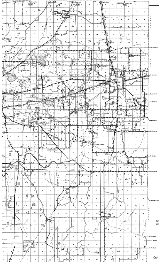
Description: This is a detailed map of the northeast portion of the county of Hillsborough in the state of Florida. Section Township Range (STR) is shown. This map shows all of the main cities, US highways, state roads, bridge highways, federal aided highway, railroads, inland waters, corporate lines, county boundaries, farm units, dwellings other than farms, state park, businesses, schools, churches, tenant houses, cemeteries, camps, seasonal dwellings, airway beacon light, power plants, post offices, forest ranger lookout station and sawmills. Key to Florida Highway maps.
Place Names: Hillsborough, Thonotosassa, Clarkwild, Temple Terrace Junction, Dover, Knights, Midway, Plant City, Youmans, Coronet, Hopewell, Durant, Pleasant Grove, Bloomingdale, Sydney, Turkey Creek, Boyette, Keysville, Picnic, Balm, Wimauma, Riverview, Lithia, Mango, Seffner
ISO Topic Categories: boundaries, location, transportation, inlandWaters
Keywords: Northeast Hillsborough, physical, political, transportation, physical features, major political subdivisions, county borders, local jurisdictions, roads, railroads, boundaries, location, transportation, inlandWaters, Unknown,1936
Source: , Florida State Road Department (Tallahassee, FL: FDOT, 1936)
Map Credit: Courtesy the private collection of Roy Winkelman. |
|