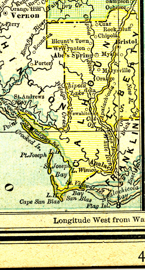
Description: A map of Calhoun County showing major cities, towns, bodies of water, county lines, and the county seat (Blountstown) current to 1890. N.B. Blountstown is labeled as BlountŐs Town and, in the inset map, the town was incorrectly placed on the west bank of the Chipola River instead of the Apalachicola River, and is not indicated as the County Seat.
Place Names: Calhoun, Chipola, Marysville, Abe Springs, Blountstown, Blount's Town, Czar, Iola, Wewahitchka,
ISO Topic Categories: boundaries, inlandWaters, oceans, transportation
Keywords: Calhoun County, physical, political, physical features, county borders, boundaries, inlandWaters, oceans, transportation, Unknown,1890
Source: George F. Cram, (Chicago, IL: Geo. F. Cram, 1890) 47
Map Credit: Courtesy the private collection of Roy Winkelman. |
|