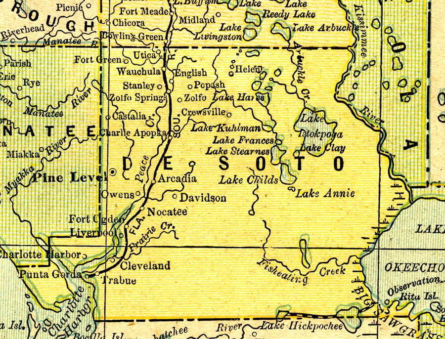
Description: A map of De Soto (Desoto) County showing towns, bodies of water, county lines, the county seat (Pine Level), and railroads connecting the major cities current to 1890.
Place Names: Desoto, Utica, Wauchula, English, Zolfo Springs, Popash, Zolfo, Crewsville, Fort Green, Charlie Apopka, Arcadia, Davidson, Cleveland, Fort Ogden, Liverpool, Trabue, Charlotte Harbor, Punta Gorda, Nocatee, Owens, Pine Level
ISO Topic Categories: boundaries, inlandWaters, oceans, transportation
Keywords: De Soto County, physical, political, transportation, physical features, county borders, railroads, boundaries, inlandWaters, oceans, transportation, Unknown,1890
Source: George F. Cram, (Chicago, IL: Geo. F. Cram, 1890) 47
Map Credit: Courtesy the private collection of Roy Winkelman. |
|