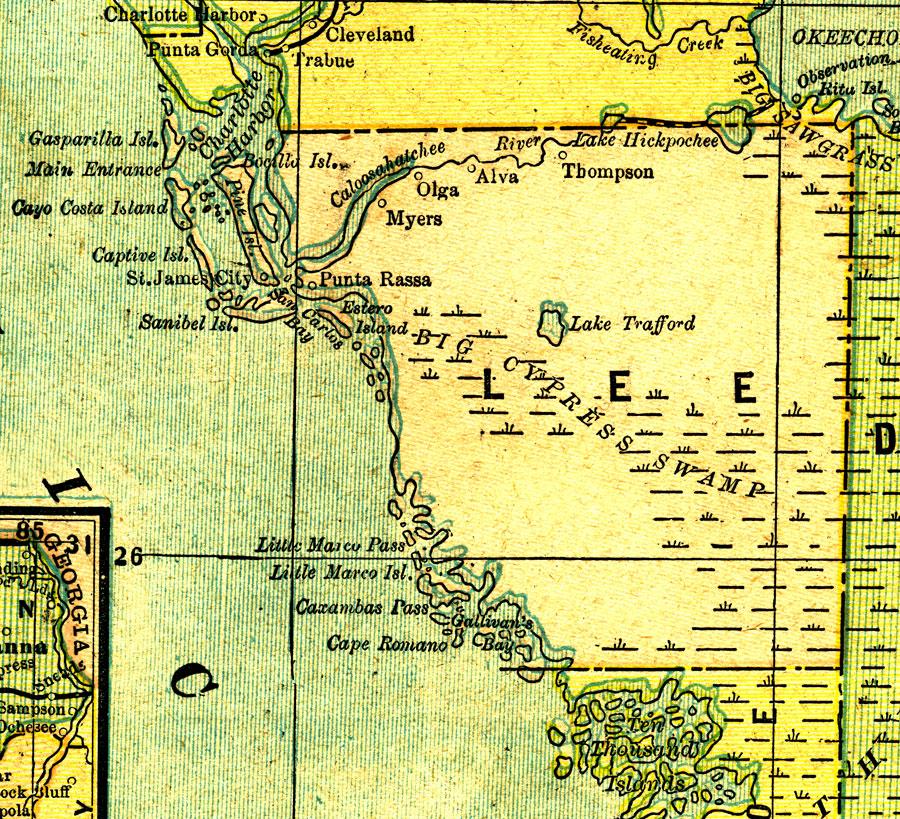
Description: A map of Lee County showing towns, bodies of water, and county lines current to 1890. No County Seat is shown on this map.
Place Names: Lee, Thompson, Olga, Myers, Punta Rassa, Estero, St. James City, Sanibel, Captiva, Alva
ISO Topic Categories: boundaries, inlandWaters, oceans, transportation
Keywords: Lee County, physical, political, transportation, physical features, county borders, railroads, boundaries, inlandWaters, oceans, transportation, Unknown,1890
Source: George F. Cram, (Chicago, IL: Geo. F. Cram, 1890) 47
Map Credit: Courtesy the private collection of Roy Winkelman. |
|