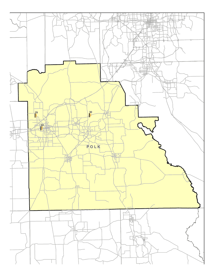
Description: This map shows the locations of Polk County's three Superfund Sites listed on the United States Environmental Protection Agency's National Priorities List (NPL). The map was created based on Environmental Protection Agency (EPA) shapefiles and metadata. Full information about each site, including each site history, narrative, and Agency for Toxic Substances and Disease Registry (ATSDR) information can be found on the U.S. EPA website. The site name, latitude/longitude, and NPL status for the Polk sites are:| 29 | Alpha Chemical Corp.
4620 N Galloway Rd.
Lakeland, FL | NPL: Deleted from NPL
Latitude: 28.100831
Longitude: -82.009719 | | 30 | Callaway and Son Drum Service
890 East Lake Alfred Drive
Lake Alfred, Ll 33850 | NPL: On final NPL
Latitude: 28.098056
Longitude: -81.714722 | | 33 | Landia Chemical Company
1405 West Olive Street
Lakeland, FL 33815 | NPL: On final NPL
Latitude: 28.039444
Longitude: -81.979167 |
Place Names: Polk, Lakeland, Lake Alfred
ISO Topic Categories: environment, health, inlandWaters, society
Keywords: Polk EPA Superfund Sites, physical, political, Hazardous Waste Sitephysical features, county borders, environment, health, inlandWaters, society, Albers_Conical_Equal,2008
Source: Florida Center for Instructional Technology, (Tampa, FL: FCIT, 2008)
Map Credit: Courtesy Roy Winkelman |
|