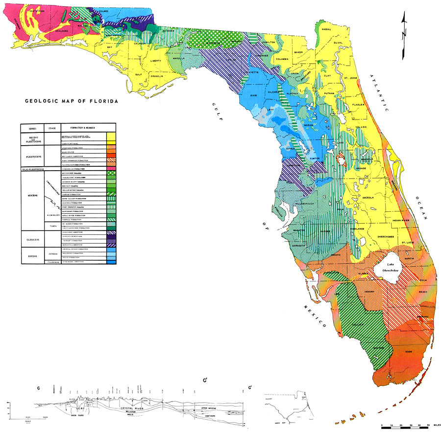
Description: This is a geologic map Florida, current to 1964. The different color and pattern codes represent the formation in that particular area. For example, the area that is all orange (mostly found in the Florida Keys) is the Key Largo Limestone from the Pleistocene Series and the solid blue is the Avon Park Limestone from the Eocene Series and Claiborne Stage. This information is found in the chart. Please see the article Geologic Map of Florida by R. O. Vernon and H. S. Puri for more information.
Place Names: 1950-1999, Counties, Hillsborough, Atlantic Ocean, Gulf of Mexico, Lake Okeechobee, Orange, St. Johns River, Suwannee River
ISO Topic Categories: boundaries, inlandWaters, oceans, environment, geoscientificInformation
Keywords: Geologic Map of Florida, physical, geologic, geologic time, geological, boundaries, inlandWaters, oceans, environment, geoscientificInformation, Unknown,1964
Source: U. S. Geological Survey, Bureau of Geology, Florida Department of Natural Resources , Florida Water Atlas (Tallahassee, FL: Bureau of Geology, 1976)
Map Credit: Courtesy the University of South Florida Library |
|