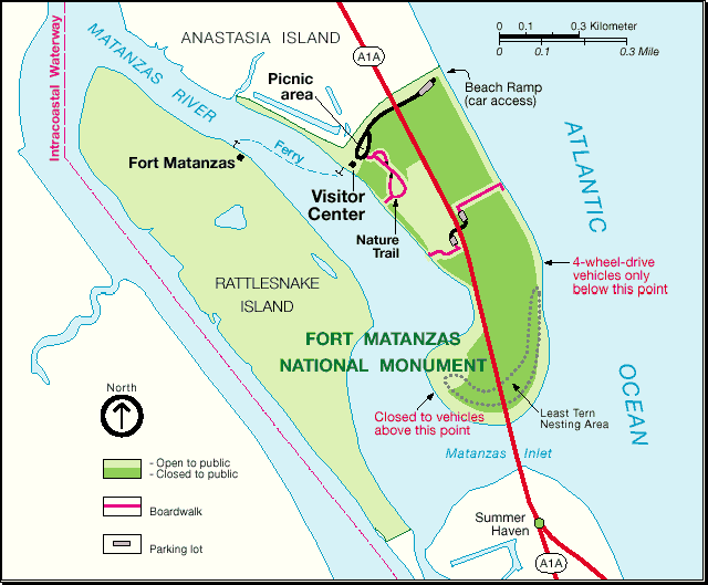
Description: A map of the Fort Matanzas National Monument and surrounding areas. The map shows the monument boundaries, the site of Fort Matanzas, areas open or closed to public access, beach ramps, picnic areas, the Intercoastal Waterway, ferry service, and a Least Tern nesting area.
Place Names: St. Johns, Anastasia Island, Fort Matanzas, Matanzas River, Rattlesnake Island, Summer Haven, Atlantic Ocean
ISO Topic Categories: boundaries, inlandWaters, oceans
Keywords: Fort Matanzas National Monument, physical, political, transportation, historical, physical features, local jurisdictions, roads, other military, boundaries, inlandWaters, oceans, Unknown,1994
Source: National Parks Service, (1994)
Map Credit: Courtesy of the National Parks Service. |
|
