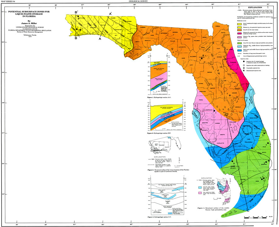
Description: This is a map of the potential subsurface zones for liquid waste storage in Florida, current to 1979. The curves are structure contour in intervals of 500 feet. It is color coded for amounts of waste found. The yellow, orange, dark pink and light pink are all moderate to low. The green, light blue and dark blue are high for all wastes. Please see the article Potential Subsurface Zones for Liquid Waste Storage in Florida by James A. Miller for more information.
Place Names: 1950-1999, Lake Okeechobee, Leon, Hillsborough, Dade, Escambia
ISO Topic Categories: boundaries, inlandWaters, environment, geoscientificInformation
Keywords: Potential Subsurface Zones for Liquid Waste Storage in Florida, physical, political, geological, county borders, boundaries, inlandWaters, environment, geoscientificInformation, Unknown,1979
Source: U. S. Geological Survey, Bureau of Geology, Florida Department of Natural Resources, Florida Bureau of Geology (Tallahassee, FL: Florida Bureau of Geology, 1979)
Map Credit: Courtesy the University of South Florida Library |
|