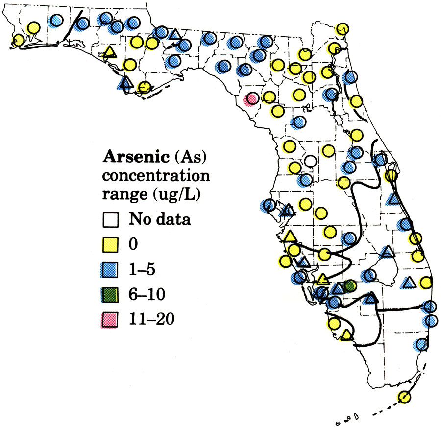
Description: This is a map showing the quality of untreated water for public supplies in Florida, specifically showing the arsenic concentration range (ug/L), current to 1979. Yellow is 0, blue is 1-5, green is 6-10 and pink is 11-20. "The injection of liquid wastes into deep saline aquifers is an alternative to surface disposal in some areas. Deep well- injection can offer an effective method of disposal with a minimal risk of pollution of surface-water or ground-water supplies, and, where done properly, has little adverse effect on wildlife or human activities." — James A. Miller. Please see the article Quality of Untreated Water for Public Supplies in Florida with Reference to the National Primary Drinking Water Regulations by W. Hull and G. A. Irwin for more information.
Place Names: 1950-1999,
ISO Topic Categories: boundaries, environment, geoscientificInformation
Keywords: Quality of Untreated Water for Public Supplies in Florida- Arsenic, physical, hydrological, political, geological, county borders, boundaries, environment, geoscientificInformation, Unknown,1979
Source: U. S. Geological Survey, Bureau of Geology, Florida Department of Natural Resources, Florida Bureau of Geology (Tallahassee, FL: Florida Bureau of Geology, 1979)
Map Credit: Courtesy the University of South Florida Library |
|
