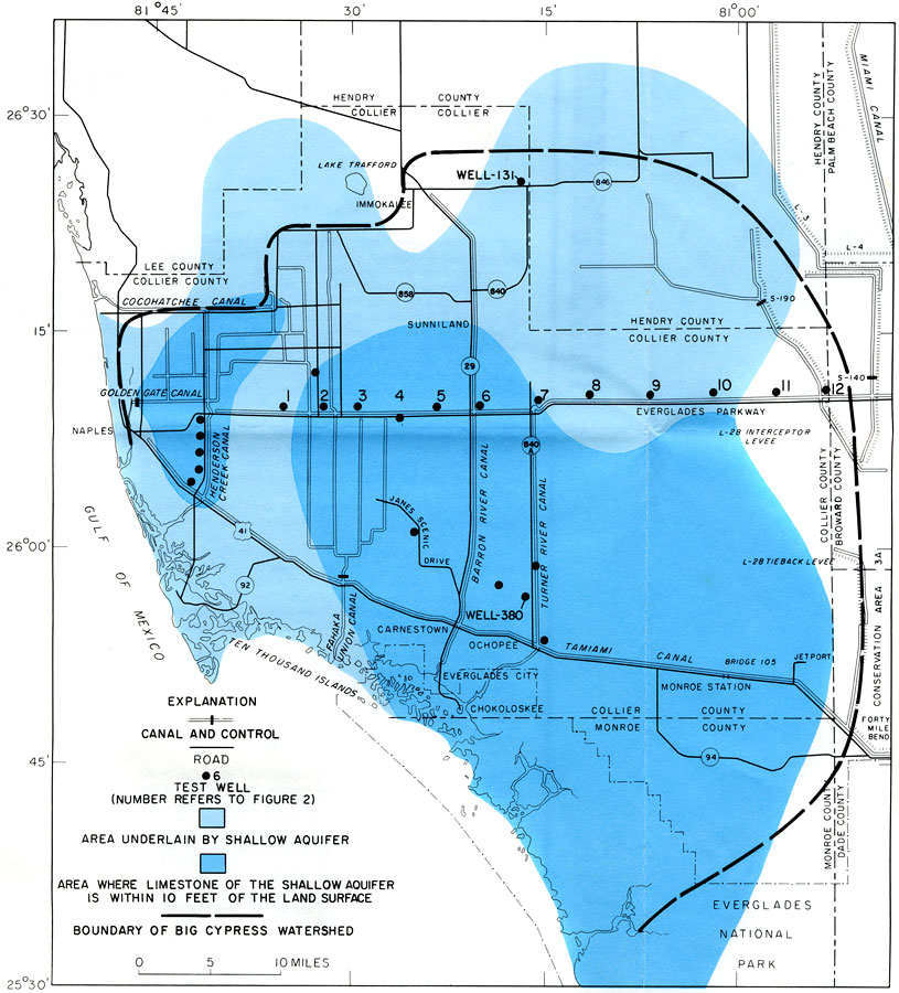
Description: This is a map showing the areal extent of the shallow aquifer of southwest Florida, current to 1972. It also shows the area where limestone is within 10 feet of the land surface. Cities, counties, roads, canals, wells and inland waters are also shown. The light blue is the area underlain by shallow aquifer and the dark blue is area where limestone of the shallow aquifer is within 10 feet of the land surface. "An extensive shallow aquifer underlies the Big Cypress Swamp and adjacent areas of southwest Florida." — Howard Klein. Please see the article The Shallow Aquifer of Southwest Florida by Howard Klein for more information.
Place Names: 1950-1999, Hendry County, Collier County, Southwest, Everglades, Chokoloskee, Lee County, Naples, Carnestown, Ochopee, Immokalee, Lake Trafford, Sunniland, Gulf of Mexico
ISO Topic Categories: boundaries, environment, geoscientificInformation, inlandWaters, transportation
Keywords: The Shallow Aquifer of Southwest Florida- Approximate Areal Extent, physical, hydrological, aquifer, political, geological, county borders, boundaries, environment, geoscientificInformation, inlandWaters, transportation, Unknown,1972
Source: U. S. Geological Survey, Bureau of Geology, Florida Department of Natural Resources, Florida Bureau of Geology (Tallahassee, FL: Florida Bureau of Geology, 1972)
Map Credit: Courtesy the University of South Florida Library |
|