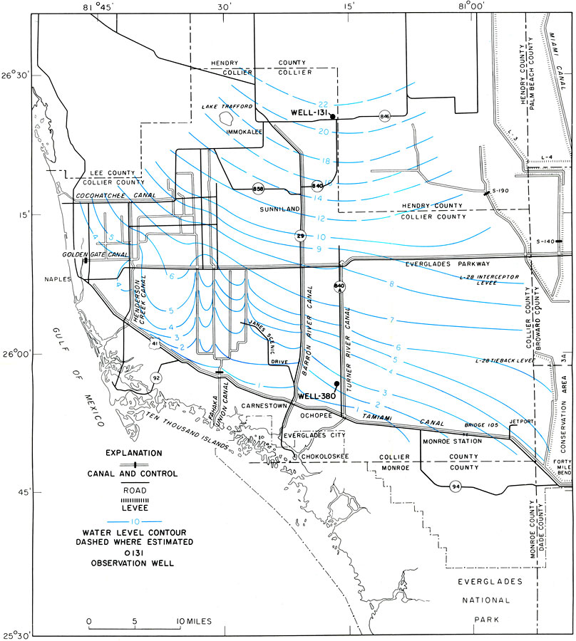
Description: This is a map showing low water-level contours of the shallow aquifer for early May 1971. It shows the location of wells and the variation in water level. The water level is indicated by blue contour lines. It also shows cities, counties, roads, canals, wells and inland waters are also shown. "An extensive shallow aquifer underlies the Big Cypress Swamp and adjacent areas of southwest Florida." — Howard Klein. Please see the article The Shallow Aquifer of Southwest Florida by Howard Klein for more information.
Place Names: 1950-1999, Hendry County, Collier County, Southwest, Everglades, Chokoloskee, Lee County, Naples, Carnestown, Ochopee, Immokalee, Lake Trafford, Sunniland, Gulf of Mexico
ISO Topic Categories: boundaries, environment, geoscientificInformation, inlandWaters, transportation
Keywords: The Shallow Aquifer of Southwest Florida- Low Water-Level Contours, physical, hydrological, aquifer, political, geological, county borders, boundaries, environment, geoscientificInformation, inlandWaters, transportation, Unknown,1971
Source: U. S. Geological Survey, Bureau of Geology, Florida Department of Natural Resources, Florida Bureau of Geology (Tallahassee, FL: Florida Bureau of Geology, 1972)
Map Credit: Courtesy the University of South Florida Library |
|