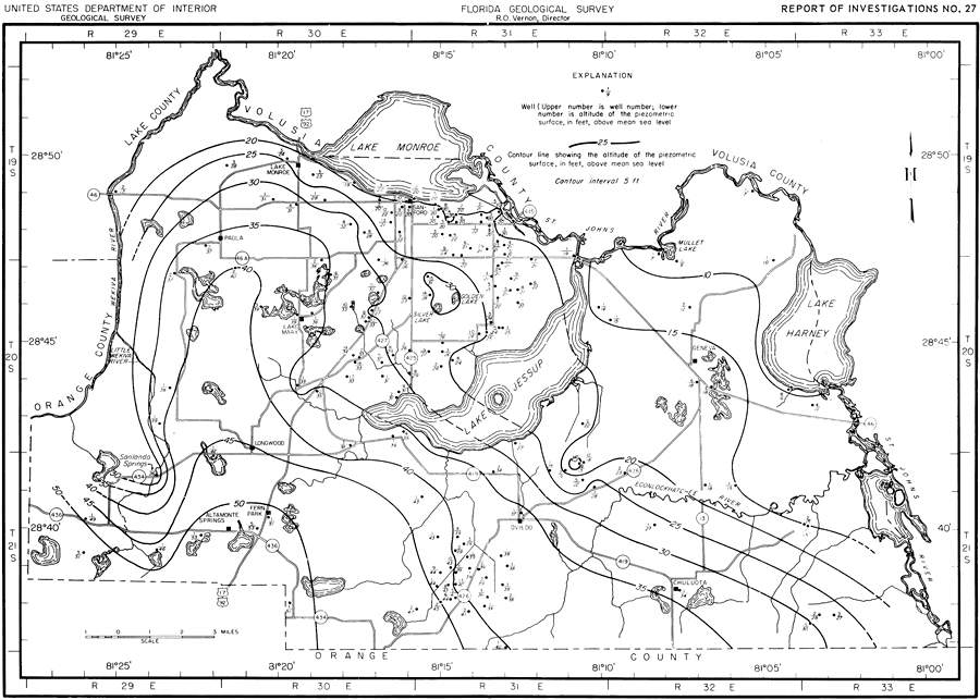
Description: This map shows the piezometric surface of the Floridian aquifer in Seminole County in June 1956. "Figure 8 shows the piezometric surface of the Floridian aquifer at near record-high conditions in June 1956. It shows a piezometric high near Golden and Silver lakes, 3.5 miles south of Sanford, which indicates that this is a recharge area." — Jack T. Barraclough, U. S. Geological Survey, 1962
Place Names: Seminole, Orange County, Lake County, Volusia County, St. Johns River, Lake Monroe, Lake Jessup, Wekiva River, Econlockhatchee River, Geneva, Lake Harney, Chuluota, Oviedo, Fern Park, Altamonte Springs, Longwood, Sanford, Paola, Lake Mary, counties
ISO Topic Categories: boundaries, geoscientificInformation, transportation, inlandWaters
Keywords: Piezometric Surface in Seminole County, physical, political, transportation, hydrological, geological, county borders, roads, boundaries, geoscientificInformation, transportation, inlandWaters, Unknown,June 1956
Source: Jack T. Barraclough, U. S. Geological Survey, Ground-Water Resources of Seminole County, Florida (Tallahassee, FL: Florida Geological Survey, 1962)
Map Credit: Courtesy the University of South Florida Library |
|