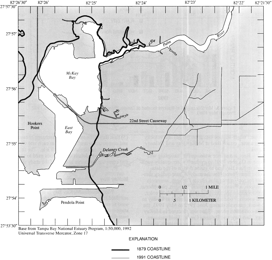
Description: This map from the U. S. Geological Survey Water Resources Investigation Report number 95-4167, Discharge, Water-Quality Characteristics, and Nutrient Loads from McKay Bay, Delaney Creek, and East Bay, Tampa, shows the shoreline changes between 1879 and 1991 in the vicinity of Tampa's East Bay and McKay Bay.
Place Names: Hillsborough, Tampa, McKay Bay, Tampa Bay, East Bay, Delaney Creek, Palm River, Pendola Point
ISO Topic Categories: boundaries, geoscientificInformation, inlandWaters
Keywords: Shoreline Changes in Tampa's McKay and East Bay, physical, physical features, boundaries, geoscientificInformation, inlandWaters, Transverse_Mercator, 1879 to 1991
Source: Y. E. Stoker, V. A. Levesque, and E. M. Fritz, USGS Water Resources Investigations Report 95-4167 (Tallahassee, FL: U. S. Geological Survey, 1996) 5
Map Credit: Courtesy the University of South Florida Library |
|