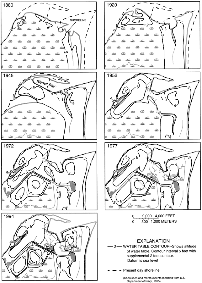
Description: These maps from the U. S. Geological Survey Water Resources Investigation Report number 97-4262, Ground-Water Flow in the Surficial Aquifer System... at Naval Station Mayport, show the evolution of the Mayport peninsula and Ribault Bay from an undeveloped area in 1880 to the site of the Naval Station Mayport, current to 1994. These maps show both the time-period shorelines and the present day shorelines, including the natural development by accretion of Ribault Bay and its eventual in-filling to develop the station. The maps also show the transition of the water table with contour lines marking the altitude in feet based on a datum of sea level.
Place Names: Duval, Mayport, Naval Station Mayport, Ribault Bay
ISO Topic Categories: boundaries, environment, geoscientificInformation, inlandWaters, oceans
Keywords: Transient Model of the Mayport Peninsula, physical, hydrological, khydrological, physical features, geological, water table, boundaries, environment, geoscientificInformation, inlandWaters, oceans, Unknown,1880 to 1994
Source: Keith J. Halford, USGS Water Resources Investigations Report 97-4262 (Tallahassee, FL: U. S. Geological Survey, 1998) 53
Map Credit: Courtesy the University of South Florida Library |
|