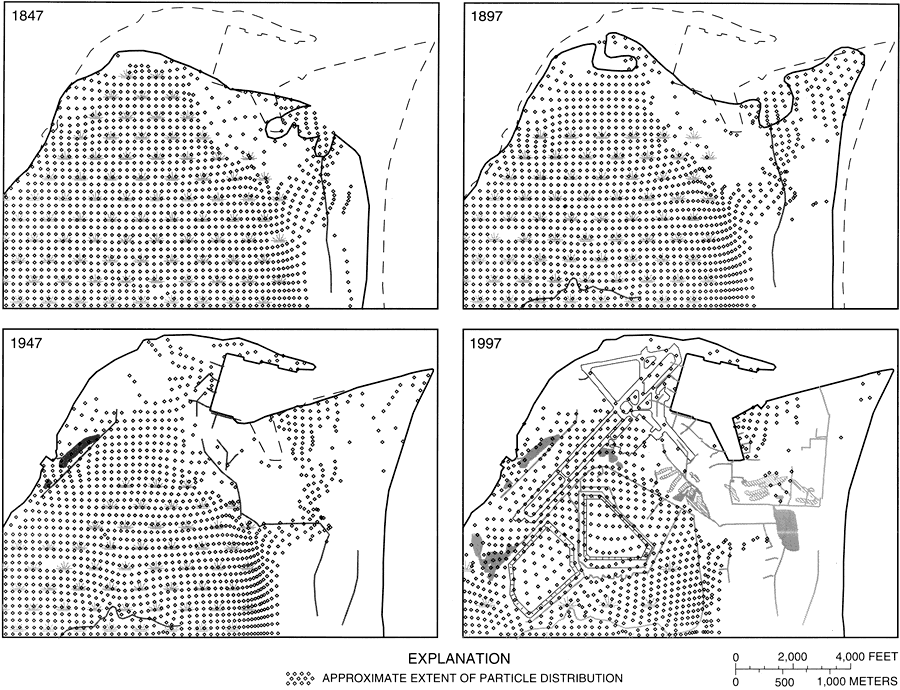
Description: These maps from the U. S. Geological Survey Water Resources Investigation Report number 97-4262, Ground-Water Flow in the Surficial Aquifer System... at Naval Station Mayport, show the simulated extent of particle distribution in the I-zone of the surficial aquifer between 1847 when the peninsula was relatively undeveloped and 1997 when the area was the established site of the Naval Station Mayport.
Place Names: Duval, Mayport, Naval Station Mayport, Ribault Bay
ISO Topic Categories: boundaries, environment, geoscientificInformation, inlandWaters, oceans
Keywords: Simulated Waterborne Particle Distribution on the Mayport Peninsula , physical, hydrological, physical features, geological, water table, boundaries, environment, geoscientificInformation, inlandWaters, oceans, Unknown,1847 to 1997
Source: Keith J. Halford, USGS Water Resources Investigations Report 97-4262 (Tallahassee, FL: U. S. Geological Survey, 1998) 55
Map Credit: Courtesy the University of South Florida Library |
|