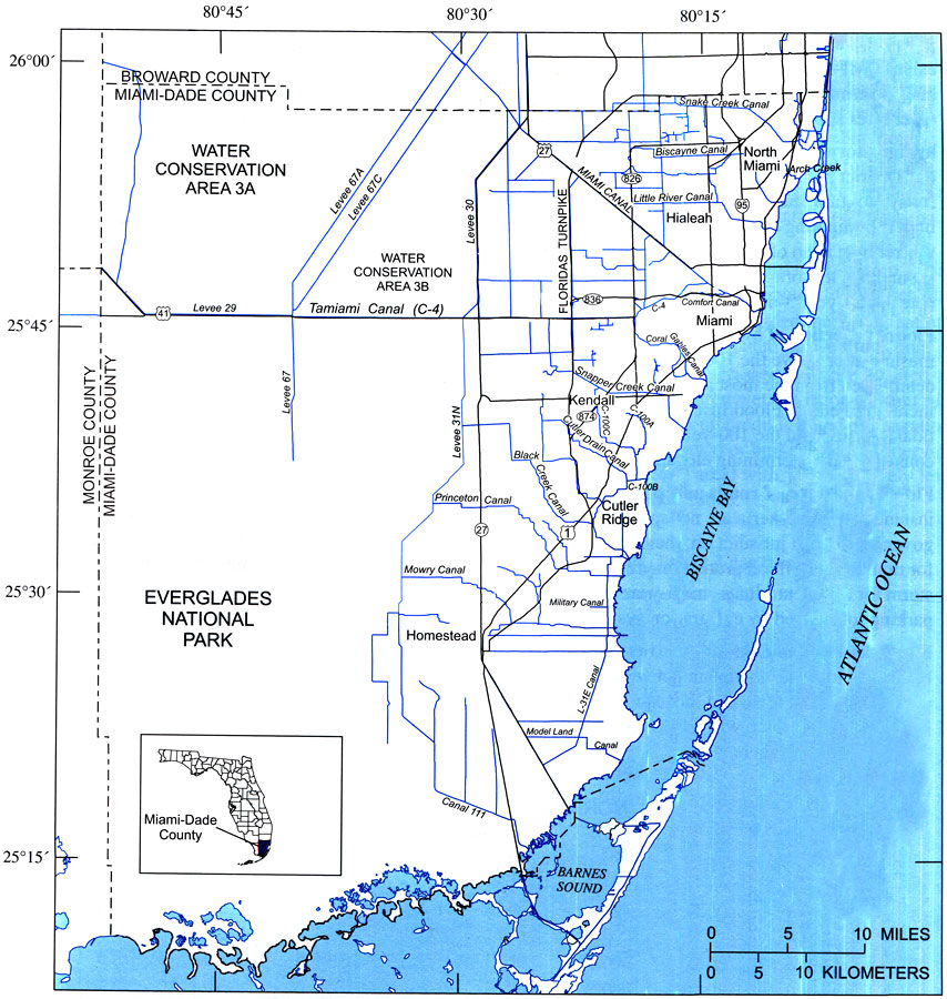
Description: This map from the U. S. Geological Survey Open-File Report number 2004-1346, An Overview of Urban Stormwater-Management Practices in Miami-Dade County, shows major roads and canal systems in the County, and the relationship between the two. The map also shows the significance of the south Florida canal system and its discharge to the Biscayne Bay.
Place Names: Miami-Dade, Homestead, Kendall, Miami, Everglades National Park, Biscayne Bay
ISO Topic Categories: boundaries, inlandWaters, oceans
Keywords: Location of Major Roads and Canals in Miami-Dade County, physical, political, transportation, hydrological, kcanals, khydrological, physical features, county borders, roads, boundaries, inlandWaters, oceans, Unknown,2004
Source: David A. Chin, USGS Open-File Report 2004-1346 (Reston, VA: U. S. Geological Survey, 2004) 5
Map Credit: Courtesy the University of South Florida Library |
|
