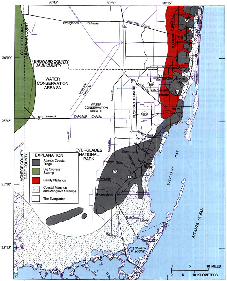
Description: This map from the U. S. Geological Survey Water Resources Investigation Report number 99-4094 shows the major physiographic features of Miami-Dade County, including the Atlantic Coastal Ridge, Big Cypress Swamp, Sandy Flatlands, Coastal Marshes and Mangrove Swamps, and the Everglades. The map also shows the major roads and canal systems.
Place Names: Miami-Dade, Homestead, Kendall, Miami, Cutler Ridge, Biscayne Bay
ISO Topic Categories: boundaries, geoscientificInformation, inlandWaters, oceans
Keywords: Physiographic Features of Miami-Dade County, physical, political, kphysiographic, physical features, geological, county borders, boundaries, geoscientificInformation, inlandWaters, oceans, Unknown,1999
Source: A. C. Lietz, USGS Water Resources Investigations Report 99-4094 (Tallahassee, FL: U. S. Geological Survey, 1999) 8
Map Credit: Courtesy the University of South Florida Library |
|