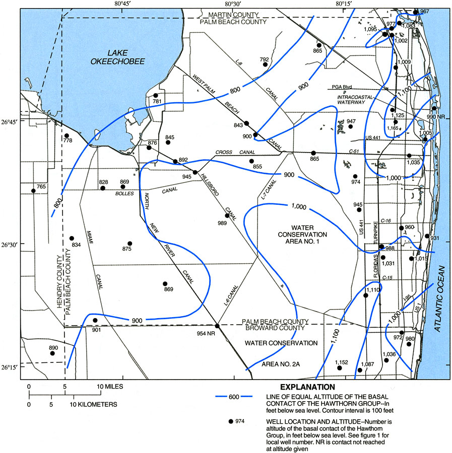
Description: This map from the U. S. Geological Survey Water Resources Investigation Report number 99-4061, Hydrology and the Distribution of Salinity in the Floridan Aquifer System, Palm Beach County, shows the altitude in feet below sea level of the basal contact zone of the Eocene-aged Hawthorn unit in Palm Beach and northern Broward counties. Also shown on the map are well sites used in the study and the canal system in the county.
Place Names: Palm Beach, Intracoastal Waterway, Lake Okeechobee
ISO Topic Categories: boundaries, geoscientificInformation, inlandWaters, oceans
Keywords: Altitude of Basal Contact of the Hawthorn Unit in Palm Beach County, physical, political, transportation, hydrological, khydrological, physical features, geological, county borders, roads, boundaries, geoscientificInformation, inlandWaters, oceans, Unknown,2000
Source: R. S. Reese and S. J. Memberg, USGS Water Resources Investigations Report 99-4061 (Tallahassee, FL: U. S. Geological Survey, 2000) 17
Map Credit: Courtesy the University of South Florida Library |
|