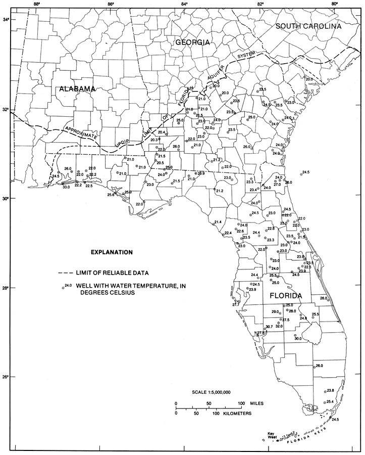
Description: This map from the U. S. Geological Survey Professional Paper 1403-1 shows temperatures measured in water samples from selected wells in the Upper Floridan aquifer, current to 1989. The dots are wells with the water temperature shown beside it in degrees Celsius. Mean annual temperatures for the area of study range from 18.6 degrees C to 25.4 degrees C. These moderate temperatures are partially shown in ground-water temperatures measured in the Upper Floridan aquifer as shown on this map.
Place Names: 1950-1999, counties, Key West
ISO Topic Categories: boundaries, geoscientificInformation
Keywords: Temperatures from the Upper Floridan Aquifer Fig 2, physical, hydrological, kFloridan aquifer, political, khydrological, geological, county borders, boundaries, geoscientificInformation, Unknown,1989
Source: Craig L. Sprinkle, USGS Professional Paper 1403-1 (Washington, : U. S. Government Printing Office, 1989) 14
Map Credit: Courtesy the University of South Florida Library |
|