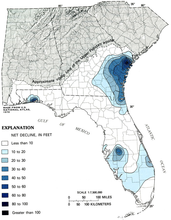
Description: This map from the U. S. Geological Survey Professional Paper 1403-C shows the net decline, in feet, between simulated predevelopment potentiometric surface and simulated May 1980 potentiometric surface of the Upper Floridan aquifer.
Place Names: 1950-1999, counties
ISO Topic Categories: boundaries, geoscientificInformation, inlandWaters, oceans
Keywords: Decline of Potentiometric Surface of the Floridan Aquifer, physical, political, hydrological, khydrological, kFloridan aquifer, physical features, geological, major political subdivisions, county borders, water table, boundaries, geoscientificInformation, inlandWaters, oceans, Unknown,1988
Source: P. W. Bush and R. H. Johnston, USGS Professional Paper 1403-C (Washington, DC: U. S. Government Printing Office, 1988) C32
Map Credit: Courtesy the University of South Florida Library |
|
