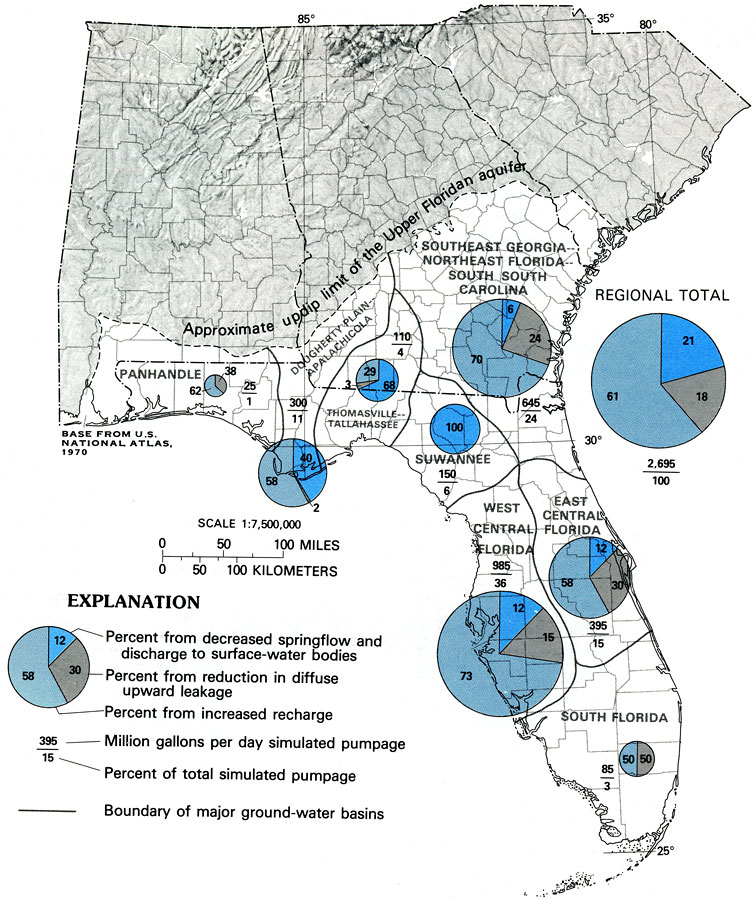
Description: This map from the U. S. Geological Survey Professional Paper 1403-C shows the sources of water supplying a simulated 1980 pumpage from the Floridan aquifer system, assuming steady-state conditions. Pie-charts show percentages from decreased springflow and discharge to surface-water bodies, reduction in diffuse upward leakage, and the percentage from increased recharge. Figures are given showing millions of gallons per day simulated pumpage over the percent of total simulated pumpage.
Place Names: 1950-1999, counties
ISO Topic Categories: boundaries, geoscientificInformation, inlandWaters, oceans
Keywords: Sources of Water Supplying Simulated 1980 Pumpage from the Floridan Aquifer, physical, political, hydrological, khydrological, kFloridan aquifer, physical features, geological, major political subdivisions, county borders, water table, boundaries, geoscientificInformation, inlandWaters, oceans, Unknown,1988
Source: P. W. Bush and R. H. Johnston, USGS Professional Paper 1403-C (Washington, DC: U. S. Government Printing Office, 1988) C65
Map Credit: Courtesy the University of South Florida Library |
|