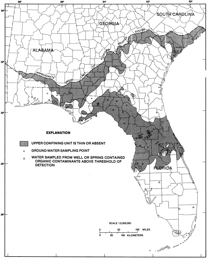
Description: This map from the U. S. Geological Survey Professional Paper 1403-1 shows wells and springs in the Upper Floridan aquifer sampled from organic contaminants, current to 1989. The shaded area shows where the upper confining unit is thin or absent. The dots are ground-water sampling points. The triangles show water sampled from well or spring that contained organic contaminants above the threshold of detection. It shows the thin confining unit or unconfined units because that is where one would find the most contamination the majority of the time.
Place Names: 1950-1999, counties
ISO Topic Categories: boundaries, geoscientificInformation
Keywords: Wells and Springs in the Upper Floridan Aquifer Fig 37, physical, hydrological, kFloridan aquifer, khydrological, political, geological, county borders, boundaries, geoscientificInformation, Unknown,1989
Source: Craig L. Sprinkle, USGS Professional Paper 1403-1 (Washington, : U. S. Government Printing Office, 1989) 185
Map Credit: Courtesy the University of South Florida Library |
|