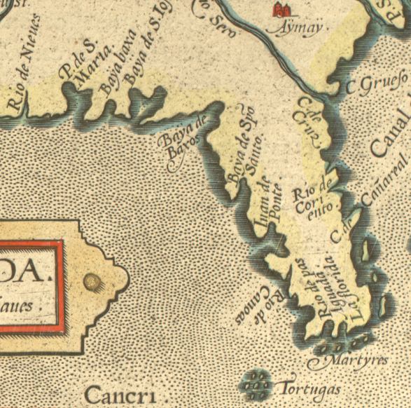
Description: This is a detail from the map drawn of Florida in 1584 by Chaves. The area shown extends across the present-day Florida panhandle and peninsula, with relief shown pictorially. The map is hand drawn with the title in decorative cartouche, and the inscription "Cum Privilegio." The map shows coastlines, rivers, and settlements. Digitization provided by the USF Libraries Digitization Center. Rare Maps Collection G3930 1584.C4.
Place Names: Before 1700,
ISO Topic Categories: oceans, inlandWaters
Keywords: La Florida - Detail, physical, physical features, oceans, inlandWaters, Unknown,1584
Source: Geronimo Chaves, Theatrum orbis terrarum (Antwerp, : Abraham Ortelius, 1584)
Map Credit: Courtesy of the Special Collections Department, University of South Florida |
|