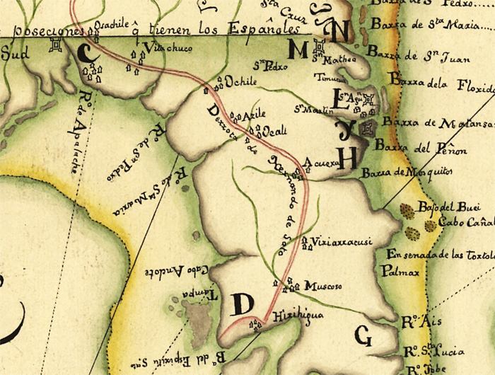
Description: This map detail is from a facsimile prepared for the Library of Congress by Jose Luis Gomez in 1914. It is from a 1742 map by Antonio de Arredondo, depicting land claim disputes between Spain and England. The map shows a red colored line in the map indicating the route of Hernando De Soto's sixteenth century entrada from the west coast of Florida into the Southeastern part of the United States.
Place Names: 1740-1759, Florida, Saint Augustine
ISO Topic Categories: inlandWaters, oceans, society
Keywords: Detail of Facsimile - Descripcion Geografica, de la parte que los Espanoles poseen Actualmente en el Continente de la Florida..., physical, political, historical, physical features, country borders, historical event, inlandWaters, oceans, society, Unknown,1670
Source: Josť Luis Gomez , (Washington, DC: Library of Congress, 1914)
Map Credit: Courtesy of the Geography and Map Division of the Library of Congress |
|
