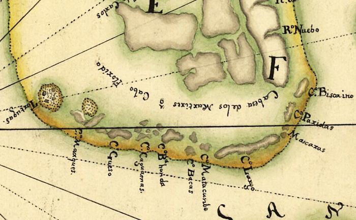
Description: This map detail is from a facsimile prepared for the Library of Congress by Jose Luis Gomez in 1914. It is from a 1742 map by Antonio de Arredondo, depicting land claim disputes between Spain and England. The map shows the southern tip of the Florida peninsula and Florida Keys.
Place Names: 1740-1759, Florida, Key West, Tortugas, Cay Gueso, Key West, Cay Bahia Honda, Cay Bacas, Cay Largo, Cay Biscaino
ISO Topic Categories: inlandWaters, oceans, society
Keywords: Detail of Facsimile - Descripcion Geografica, de la parte que los Espanoles poseen Actualmente en el Continente de la Florida..., physical, political, physical features, country borders, inlandWaters, oceans, society, Unknown,1670
Source: Josť Luis Gomez , (Washington, DC: Library of Congress, 1914)
Map Credit: Courtesy of the Geography and Map Division of the Library of Congress |
|
