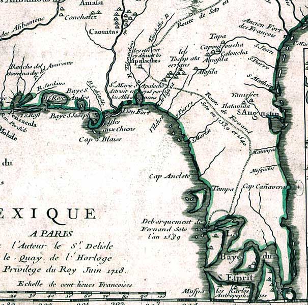
Description: This detail is from the 1718 DeLisle map titled "Carte de la Louisiane et du cours du Mississipi [i.e. Mississippi]: dressee sur un grand nombre de memoires entrautres sur ceux de Mr. le Maire / par Guillaume Del'isle del Academie R'le. des Sciences." and published by Chez l'auteur le Sr. Delisle sur le quay de l'horloge avec privilege du roy. Although DeLisle was the first major geographer to disregard the fallacy that California was an island, this map shows the Baye du S. Esprit, or Tampa Bay, extending eastward to the Atlantic Ocean. Additionally, the Caloosa (Les Carlos)natives at the southern tip of Florida are labeled as cannibals (Antropophages). This was the first printed map to show the route of Hernando de Soto in 1539-40 from his disembarkment on the Gulf Coast northward. The map shows coastlines, major rivers, and European and Native American settlements.
Place Names: 1740-1759, Florida, Saint Augustine, Cape Canaveral
ISO Topic Categories: inlandWaters, oceans, society
Keywords: Detail - Carte de la Louisiane et du cours du Mississipi, physical, historical, physical features, inlandWaters, oceans, society, Unknown,1718
Source: Guillaume de L'Isle, (Paris, : , 1718)
Map Credit: Courtesy of the Geography and Map Division of the Library of Congress |
|
