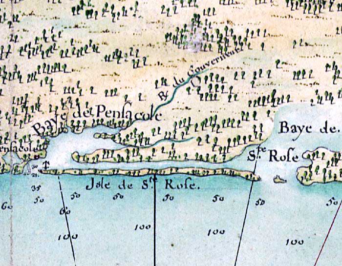
Description: This detail from the 1732 map "Carte de la cote de la Louisiane depuis la Baye St. Joseph, jusqu'a celle de St. Bernard ou tous les ports et bons mouillages sont marquez par des ancres; avec la quantite de pies d'eau que l'on y trouve" shows Baye Pensacole (Pensacola Bay) and Baye Ste Rose (Santa Rosa Sound and Choctawhatchee Bay) with soundings and anchorage locations for navigation. The detail also shows Pensacole (Pensacola), and R. du Gouvernear, presumably the Escambia River, and an unnamed river that is likely Blackwater River, although both are oriented more easterly on the map than geographically correct.
Place Names: 1720-1739, Baye de Pensacole,Pensacola Bay, Pensacole, Pensacola, Isle de Ste Rose,Santa Rosa Island, Baye de Ste. Rose, Santa Rosa Sound, Choctawhatchee Bay
ISO Topic Categories: inlandWaters, oceans, society
Keywords: Detail - Carte de la cote de la Louisiane depuis la Baye St. Joseph, physical, hydrological, physical features, water depths, inlandWaters, oceans, society, Unknown,1732
Source: , (, : , 1732)
Map Credit: Courtesy of the Geography and Map Division of the Library of Congress |
|
