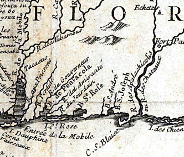
Description: Detail from the 1744 map "Carte de la Louisiane cours du Mississipi [i.e. Mississippi] et pais voisins : dediee a M. le Comte de Maurepas, ministre et secretaire d'etat commandeur des ordres du roy / par N. Bellin ingenieur de la marine, 1744 ; Dheulland sculp"e; showing the Gulf Coast from near I. des Chien (Dog Island) to Entree de la Mobile (Mobile Bay). Major rivers, including the R. des Apalachicolis (Apalachicola River) and coastal features such as Baye de Pensacole (Pensacola Bay) and I. Se. Rose (Santa Rosa Island) are shown. Relief is shown pictorially, and longitude is based on the Paris prime meridian.
Place Names: 1740-1759, Florida, R. du Gouverneur, Baye de Pensacola, Pensacola Bay, Baye Se. Rose, Santa Rosa Sound, Choctawhatchee Bay, Baye S. Andre, St. Andrew Bay, Baye S. Joseph, St. Joseph Bay, R. des Apalachicolis, Apalachicola River, C. S. Blaise, Cape San Blas, I. des Chien, Dog Island
ISO Topic Categories: inlandWaters, oceans, society
Keywords: Detail - Carte de la Louisiane cours du Mississipi et pais voisins , physical, political, historical, physical features, major political subdivisions, inlandWaters, oceans, society, Unknown,1744
Source: Jacques Nicolas Bellin, (Paris, : , 1744)
Map Credit: Courtesy of the Geography and Map Division of the Library of Congress |
|
