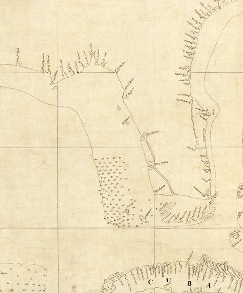
Description: This detail is from the 1757 map "Descripcion de la costa de Tierra Firme desde el Rio de la Empalizada hasta Cavo de Clara. Por las latitudes y longitudes de Dn. Bartolome de Rosa. Echo por Balentin Cierto primer Piloto de la Real Armada, aņo de 1757" showing peninsular Florida, northern Cuba, and the Gulf Coast from Cape Sable to Santa Rosa Bay. The map is from Balentin Cierto, a pilot in the Spanish Royal Navy, so the information provided on the map is meant primarily for navigation purposes, such as the soundings around the Tortugas, and the major coastal features such as harbors and bays with their labels oriented to be read clockwise traveling around the peninsula. This results in the labels along the Atlantic appearing upside down.
Place Names: 1740-1759,
ISO Topic Categories: oceans
Keywords: Detail - Descripcion de la costa de Tierra Firme desde el Rio de la Empalizada hasta Cavo de Clara, physical, physical features, oceans, Unknown,1757
Source: Balentin Cierto , (, : , 1757)
Map Credit: Courtesy of the Geography and Map Division of the Library of Congress |
|
