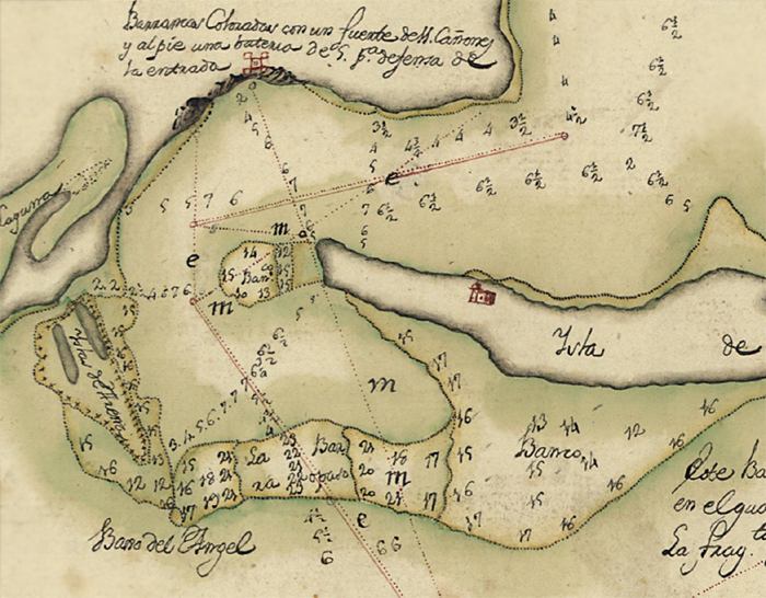
Description: This detail of Santa Rosa Island and the mouth of Pensacola Bay is from a pen-and-ink and watercolor 1782 map of Pensacola Bay. It shows Fort Barrancas on the mainland and a building on Santa Rosa Island, and includes sailing directions for entering the bay. Relief is shown pictorially, and depths are shown by soundings.
Place Names: 1780-1799, Pensacola, Pensacola Bay, Santa Rosa Island
ISO Topic Categories: inlandWaters, oceans, society
Keywords: Detail - Plano de la bahia de Pansacola, physical, transportation, historical, physical features, water routes, inlandWaters, oceans, society, Unknown,1782
Source: Antonio Donato Paredes, (Cadiz, : , 1782)
Map Credit: Courtesy of the Geography and Map Division of the Library of Congress |
|