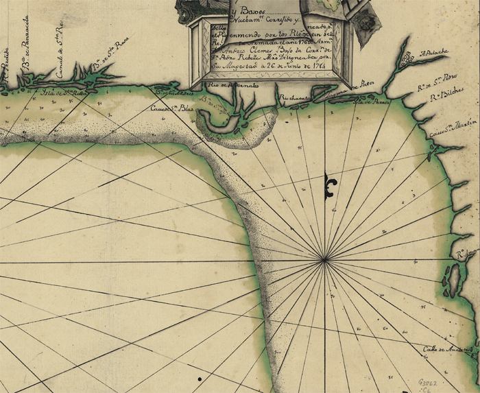
Description: A detail of Florida's northwest coastline from a pen-and-ink and watercolor map from 1784 of the Gulf Coast between the Anclote Keys in Florida and the mouth of the Mississippi River. Depths shown by soundings, and the submerged Florida platform is shown.
Place Names: 1780-1799, Bahia de Panzacola, Pensacola Bay, Canal de Santa Rosa, Santa Rosa Sound, Apalache, San Marcos de Apalache, Callo de Anclotes, Anclote Keys, Pensacola
ISO Topic Categories: inlandWaters, oceans, society
Keywords: Detail - Descripsion de la costa de la Luciana ..., physical, historical, physical features, inlandWaters, oceans, society, Unknown,1784
Source: Andres Clemes , (, : , 1784)
Map Credit: Courtesy of the Geography and Map Division of the Library of Congress |
|
