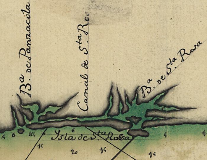
Description: A detail Pensacola Bay, Santa Rosa Sound, and Choctawhatchee Bay from a pen-and-ink and watercolor map from 1784 of the Gulf Coast between the Anclote Keys in Florida and the mouth of the Mississippi River. Depths shown by soundings.
Place Names: 1780-1799, Bahia de Panzacola, Pensacola Bay, Canal de Santa Rosa, Santa Rosa Sound, Isla de Santa Rosa, Santa Rosa Island,Bahia de Santa Rosa, Choctawhatchee Bay
ISO Topic Categories: inlandWaters, oceans, society
Keywords: Detail - Descripsion de la costa de la Luciana ..., physical, historical, physical features, inlandWaters, oceans, society, Unknown,1784
Source: Andres Clemes , (, : , 1784)
Map Credit: Courtesy of the Geography and Map Division of the Library of Congress |
|
