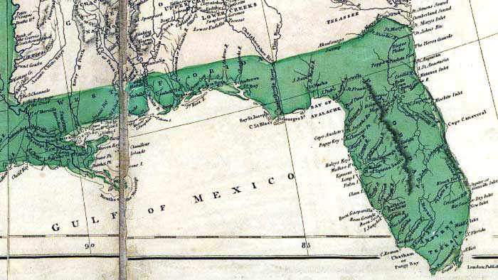
Description: This detail is from an 1802 hand-colored map of North America showing the various explorations and discoveries of the time. The map also indicates territories claimed by France and Spain. Relief shown by hachures. This detail shows the Spanish territories of East and West Florida, which covered the entire peninsula and Gulf Coast to the Mississippi River at that time. The map shows coastal features, major rivers, and settlements. Several of the place names reflect British influence such as Chatham Bay at the southwestern tip of the Florida peninsula. The full title of the map is: "A map exhibiting all the new discoveries in the interior parts of North America / inscribed by permission to the honorable governor and company of adventurers of England trading into Hudsons Bay in testimony of their liberal communications to their most obedient and very humble servant A. Arrowsmith, January 1st 1795."
Place Names: 1800-1819, Pensacola, Cape San Blas, St. Marks, Bay of Spiritu Santo, Tampa Bay, Charlotte Harbour, Charlotte Harbor, Cape Roman, Chatham Bay, Punjo Bay, Cape Canaveral, Moskito Inlet, St. Augustine, Saint Augustine, St. Johns River, St. Marys Inlet
ISO Topic Categories: boundaries, inlandWaters, oceans, society
Keywords: Detail - A map exhibiting all the new discoveries in the interior parts of North America , physical, political, historical, physical features, major political subdivisions, boundaries, inlandWaters, oceans, society, Unknown,1802
Source: Aaron Arrowsmith, (London, : A. Arrowsmith, 1802)
Map Credit: Courtesy of the Geography and Map Division of the Library of Congress |
|