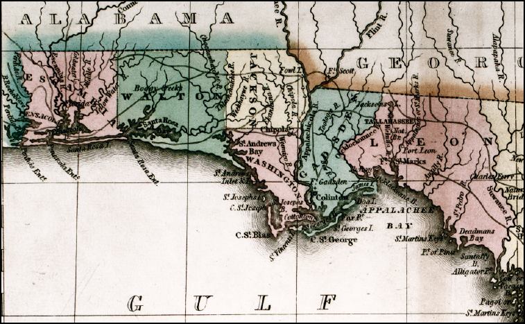
Description: This 1827 map shows major rivers, lakes, coastal features, settlements, and roads in Florida. There are six counties shown in this detail: Escambia, Walton, Jackson, Washington, Gadsden, and Leon, which differs from the number found on current maps for the same area.
Place Names: 1820-1839, Fort St. Marks, St. Marks, Appalachicola River, Apalachicola River, Appalachee Bay, Apalachee Bay, Santa Rosa Bay, Pensacola, Escambia River, Tallahassee, Escambia County, Walton County, Jackson County, Washington County, Gadsden County, Leon County
ISO Topic Categories: boundaries, inlandWaters, oceans, transportation
Keywords: Geographical, statistical, and historical map of Florida, physical, political, historical, transportation, physical features, major political subdivisions, county borders, roads, boundaries, inlandWaters, oceans, transportation, Unknown,1827
Source: Joseph Drayton, A complete historical, chronological, and geographical American atlas (Philadelphia, PA: Carey and Lea , 1827) Plate 37
Map Credit: Courtesy of the Special Collections Department, University of South Florida |
|