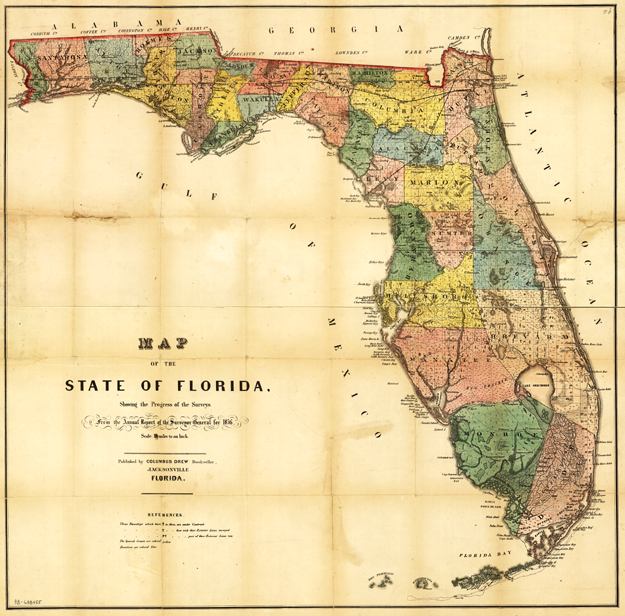
Description: This map from the annual report of the Surveyor General in 1856 shows drainage, cities and towns, roads, trails, and location of two railroad lines in the northern part of the state. Township grids based on the Tallahassee base line parallel and the Tallahassee prime meridian shows the extent of land survey in Florida and the fact that much of the Everglades and the Forbes Purchase or Forbes Grant in northern Florida were not surveyed in 1856.
Place Names: 1840-1859, Cape Canaveral, Charlotte Harbor, Jacksonville, Saint Augustine, Key West, Lake Okeechobee, Pensacola, St. Marks, Tallahassee, Tampa
ISO Topic Categories: boundaries, inlandWaters, oceans, society, transportation
Keywords: Map of the State of Florida , physical, political, transportation, physical features, major political subdivisions, county borders, local jurisdictions, roads, railroads, boundaries, inlandWaters, oceans, society, transportation, Unknown,1856
Source: Columbus Drew, (Jacksonville, FL: Columbus Drew, 1856)
Map Credit: Courtesy of the Geography and Map Division of the Library of Congress |
|