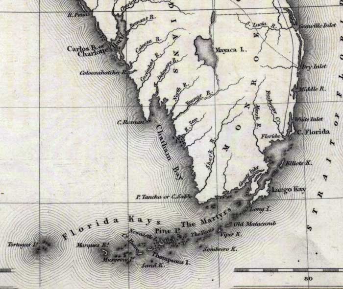
Description: Digitization provided by the USF Libraries Digitization Center. Rare Maps. This is a map of Monroe County, circa 1832. It shows county boundaries, cities and towns and inland waters. Key West is shown as Thompsons Island on this map. Scale [ca. 1:4,181,760]
Place Names: Monroe, Key West, Thompsons Island, Mangrove Island, Largo Kay, Key Largo, Sombrero Key, Carlos Bay, Charlotte Harbor, Caloosahatchee River, Cape Romano, Cape Sable, Big Pine, Newcastle Island, Pine Islands
ISO Topic Categories: inlandWaters, oceans, transportation, boundaries
Keywords: Monroe County, historical, political, transportation, county borders, railroads, inlandWaters, oceans, transportation, boundaries, Unknown,1832
Source: Fenner Sears and Co., engraver & printer, The History and Topography of the United States (London, : Hinton, I. T. Simpkin, Marshall and Co., 1832)
Map Credit: Courtesy of the Special Collections Department, University of South Florida. |
|