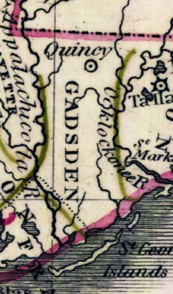
Description: Digitization provided by the USF Libraries Digitization Center. Rare Maps. This is a map of Gadsden County, circa 1830. It is a portion of Rand McNally and Co.'s new business map of Florida. It shows county boundaries, cities and towns, and inland waters.
Place Names: Gadsden, Quincy, Ocklocknee River, Apalachicola River, St. Marks
ISO Topic Categories: inlandWaters, oceans, boundaries
Keywords: Gadsden County, historical, physical, political, physical features, county borders, inlandWaters, oceans, boundaries, Unknown,1830
Source: Joseph Meyer, Rand McNally and Co.'s new business map of Florida (and) Rand McNally and Co.'s indexed atlas of the world (Philadelphia, PA: Rand McNally and Co., 1830)
Map Credit: Courtesy of the Special Collections Department, University of South Florida. |
|