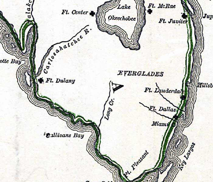
Description: This detail is from Russell's 1862 historical war map showing the southern portion of the Florida peninsula. The detail shows locations for Army forts McRae, Jupiter, Lauderdale, Dallas, Dulany and Ft. Center. The town of Miami is shown, as well as the Everglades, Lake Okeechobee, and the Caloosahatchee River, which is shown on the map using an older version of the name, Carlosahatchee River.
Place Names: 1860-1879, Ft. McRae, Ft. Jupiter, Ft. Lauderdale, Ft. Dallas, Miami, Pt. Pleasant, Ft. Dulany, Ft. Center, Lake Okeechobee, Carlosahatchee River, Caloosahatchee River
ISO Topic Categories: inlandWaters, oceans, society
Keywords: Detail - The historical war map, physical, political, statistical, historical, physical features, major political subdivisions, population, Civil War, inlandWaters, oceans, society, Unknown,1862
Source: Benjamin B. Russell, The historical war map (Buffalo, NY: Asher & Co. , 1862)
Map Credit: Courtesy of the Geography and Map Division of the Library of Congress |
|