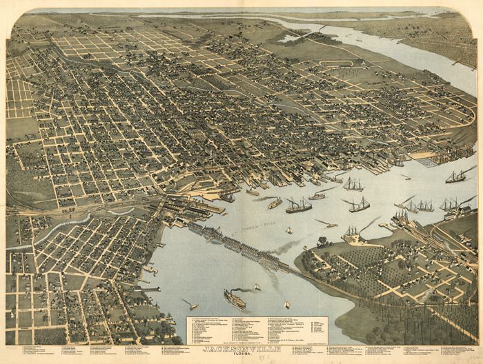
Description: This map is of a panoramic view of Jacksonville, current to 1893. The map shows details about streets, harbors, bridges, railroads, and ship yards. Labeled on the map are the Courthouse, the County Jail, the hospital, schools, churches, hotels, and other businesses. Also marked on the map are Mayport, the Atlantic Ocean, Fort George, Pilot Town, New Berlin, Fernandina, and Hart's Junction. The Saint Johns River is the centerpiece for the area. The map is from a bird's-eye-view and is drawn to perspective rather than scale. The perspective is from northwest to southeast.
Place Names: Duval, Saint Johns River, Jacksonville
ISO Topic Categories: inlandWaters, oceans
Keywords: Jacksonville Florida, physical, transportation, physical features, roads, railroads, inlandWaters, oceans, Unknown,1893
Source: Augustus Koch, (Kansas City, MO: Hudson-Kimberly Publishing Company, 1893)
Map Credit: Courtesy of the Geography and Map Division of the Library of Congress |
|