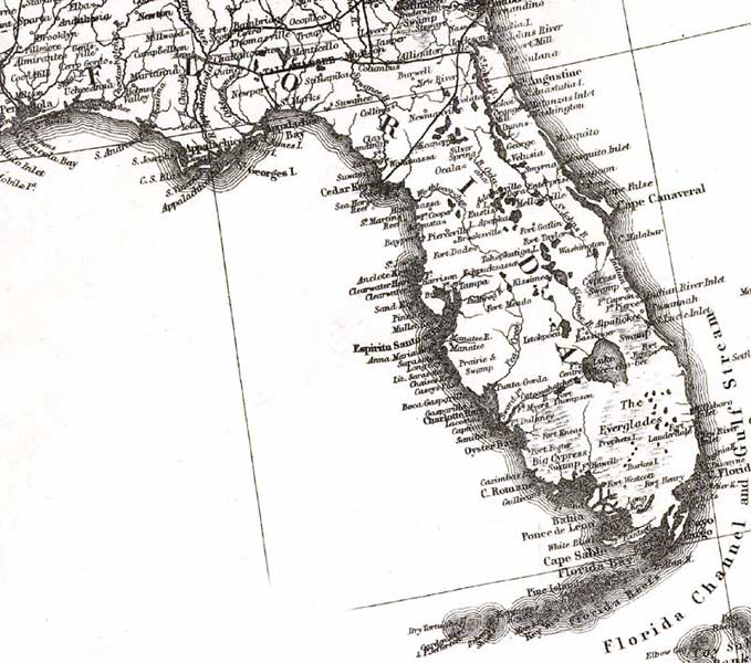
Description: A detail from Colton's general map of the United States showing Florida with relief indicated by hachures, drainage, and the railroad network with emphasis on the main lines.
Place Names: 1860-1879, Pensacola, Appalachicola, Tallahassee, Alligator, Apalachicola, Cape Canaveral, Cedar Key, Ft. Lauderdale, Jacksonville, Key West, Lake Okeechobee, Saint Augustine, Charlotte Harbor, Tampa
ISO Topic Categories: boundaries, inlandWaters, oceans, transportation
Keywords: Detail - Texas and Pacific Railway and its connections, physical, transportation, historical, physical features, railroads, boundaries, inlandWaters, oceans, transportation, Unknown,1876
Source: G.W. & C.B. Colton, (New York, NY: G.W. & C.B. Colton & Co. , 1876)
Map Credit: Courtesy of the Geography and Map Division of the Library of Congress |
|