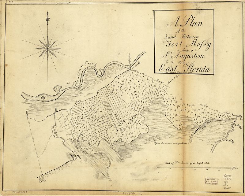
Description: This is a map of the plan of the land between Fort Mossy, or Fort Mose, and Saint Augustine in the province of East Florida. It shows "Spanish old fields overgrown with scrubs." The map shows marshes and the Saint Sebastian Creek. The map is oriented with north to the right. The scale is 1:7,900.
Place Names: St. Johns, Fort Mose, Fort Mossy, Saint Sebastian Creek,
ISO Topic Categories: inlandWaters, location
Keywords: A plan of the land between Fort Mossy and St. Augustine, physical, physical features, inlandWaters, location, Unknown,1760s
Source: Sam Roworth, (, : , 1760)
Map Credit: Courtesy of the Geography and Map Division of the Library of Congress |
|