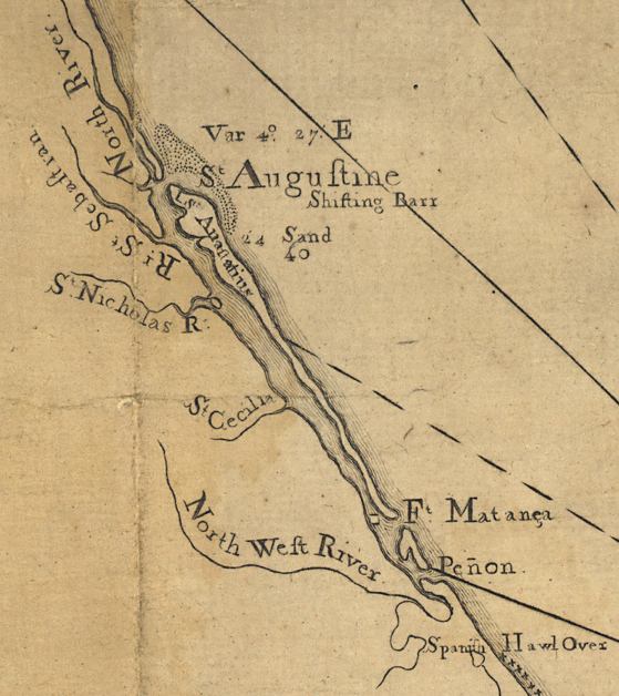
Description: This detail of Saint Augustine is from a map drawn in 1774, part of a two map set showing the northern portion of the Florida peninsula. It is primarily a navigational chart with rhumblines, soundings, and coastal features. The map includes sailing directions. Relief is shown by hachures. Depths shown by soundings. This detail shows Saint Augustine with many rivers, such as the North River and North Weft [sic] River. Also shown is Fort Matanza.
Place Names: St. Johns, Fort Matanzas, St Augustine, Saint Sebastian River,
ISO Topic Categories: inlandWaters, oceans, society, transportation
Keywords: Detail - East and West Florida, physical, historical, transportation, physical features, water routes, inlandWaters, oceans, society, transportation, Unknown,1774
Source: Bernard Romans, A concise natural history of East and West Florida (New York, NY: Peter Force, 1781)
Map Credit: Courtesy of the Geography and Map Division of the Library of Congress |
|