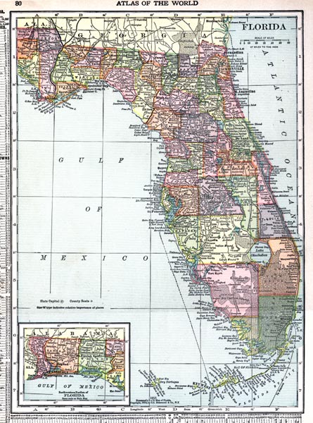
Description: This map of Florida shows county boundaries, roads, cities, towns, villages, lakes, and rivers current to 1916. There is an inset map of the panhandle or northwest portion of Florida. This map has counties and major cities and towns listed in larger font. The counties are also colored for ease of differentiation. The scale is 47 miles to the inch.
Place Names: 1900-1919, Key West, Orlando, Tampa, Cape Canaveral, Saint Augustine, Pensacola, Fort Myers, Fort Lauderdale, Daytona Beach, Gainesville, Jacksonville, Miami, Sarasota, Tallahassee, St Petersburg, West Palm Beach, Naples, Atlantic Ocean, Gulf of Mexico,
ISO Topic Categories: boundaries, transportation, inlandWaters, oceans
Keywords: Florida, physical, political, transportation, swamps, everglades, wetlands, physical features, county borders, roads, boundaries, transportation, inlandWaters, oceans, Unknown,1916
Source: , New Reference Atlas of the World (New York, NY: C.S. Hammond & Company, 1916) 84
Map Credit: Courtesy the private collection of Roy Winkelman. |
|